Engineered for partners and resellers in the remote sensing industry, the Remote Sensing Payload Instrument, or RESEPI®, is a combined Dual Antenna GNSS-Aided Inertial Navigation System, datalogger, LiDAR, camera and communications system.
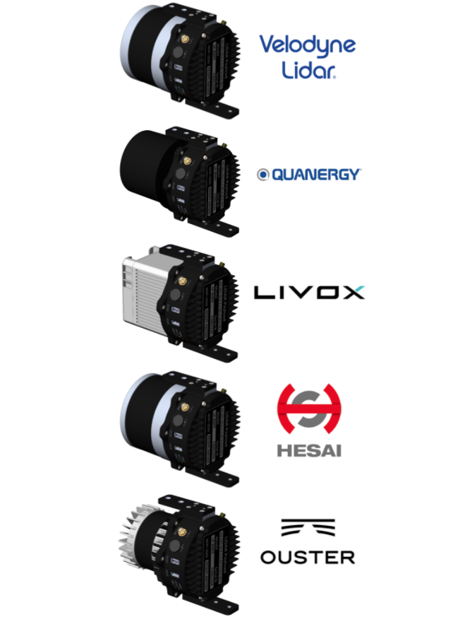
Engineered for partners and resellers in the remote sensing industry, the Remote Sensing Payload Instrument, or RESEPI®, is a combined Dual Antenna GNSS-Aided Inertial Navigation System, datalogger, LiDAR, camera and communications system that allows for the real time and post-processed generation of point cloud solutions. The processing platform contains a WiFi interface, embedded cellular modem to support RTCM corrections, data logging software and gigabit ethernet. RESEPI® can be used with commercially available LiDARs like Velodyne, Quanergy, Ouster, RIEGL, LIVOX, and Hesai. The device was built with the purpose of white-labeling.
Your Logo can be placed on all software: LIDAR calibration software, Bore-sighting software, Point Cloud Software, web-interfaces, and hardware. All components are mounted into one compact and light-weight enclosure.

RESEPI® is completely modular. You can supply the GNSS receiver. You can supply the LiDAR. We provide everything for assembling, calibrating, and bore-sighting RESEPI®. This allows you to maintain existing relationships and meet local production requirements. You have full control for customization.
RESEPI® is ALSO a complete remote sensing solution – LiDAR, all required cables, mounting brackets, vibration isolator, LiDAR Calibration, Bore-sighting, Post-Processing (PPK) and Point Cloud software. Value Added Resellers can focus on growing their business rather than developing the payload product. We will support and grow the product together to meet the market requirements with a commitment to supplying the best price/performance solution to our Business Partner.

As the remote sensing market continues to progress, so do the necessary hardware and software solutions that enable partners to provide end-users with quality deliverables. The streamlined process provides by the RESEPI allows for one-click processing as well as real-time data output from the payload to assist in machine learning and localized mapping algorithm development. The Inertial Labs team provides a custom branded hardware and software solution for partners to be able to develop their own personalized service. In future iterations of the RESEPI, the use of NVIDIA graphics will allow for even more in-depth computer vision and machine learning applications.
Value Added Resellers can focus on growing their business rather than developing or producing their desired final payload product. Allow us to assist you, and we will support and grow the product together to meet the market requirements you desire with a personal commitment to supplying you with the best price/performance solution.
By Inertial Labs providing the White-Label solution, partners get to focus on quality lead generation and customer relationships instead of prioritizing the tedious processes needed for quality manufacturing and R&D.
The RESEPI platform was built for growth. Whether your market is autonomous navigation (SLAM), surveying, or inspections for construction sites, RESEPI is modular and built to fuel the projects of tomorrow. Inertial Labs offers opportunities to partner with companies who are interested in taking scanning solutions to the next level. Future iterations of RESEPI are expected to have high-performance GPU’s and CPU’s to aid in bringing solutions to the world of autonomy.
Sometimes called a 3D laser scanner, LiDAR isa surveying method that measures distance to a target by illuminating the target with pulsed laser light and measuring the reflected pulses with a sensor. It has terrestrial, airborne, and mobile applications. Some models of 3D LiDAR are able to generate up to 700,000 data points per second, There are plenty of exceptional producers on the market, for example Quanergy®(2) and Velodyne®.
Perhaps area mapping is still the biggest domain for remote sensing. Making sense of the physical world by analyzing maps and 3D models allows businesses to make faster and more informed decisions that increase efficiency, profit and more importantly, improve safety. Few of the most often used bases it can be done on are a land vehicle or Unmanned Aerial Vehicles (UAV).
LiDAR technology is instrumental in developing 3D models of farmland, which can be used to aid crop planning and can produce accurate maps of the natural resources. In addition, it can be used in crop yield forecasting, field management, land segmentation, and determination of soil type.
RESEPI has the ability to generate a point cloud in real time. This feature, along with aiding imagery from other optical sources such as RGB and thermal cameras, can lay the foundation for SLAM algorithm development.
Drones equipped with LiDAR and Photogrammetry technology are a much cheaper and safer option when compared to other aerial scanning methods or manual inspection. With innovative LiDAR and Photogrammetry algorithms, users can reconstruct utilities and identify potential hazards and damages.
Drones equipped with RGB cameras and LiDAR technology enable construction companies to regularly monitor project progress. In addition, LiDAR point cloud color schemes are a useful tool for the visualization of elevation, which makes 3D analysis of the ground and structures much easier.


Trademark Legal Notice: All product names, logos, and brands are property of their respective owners. All company, product and service names used in this document are for identification purposes only. Use of these names, logos, and brands does not imply endorsement. Kongsberg/Seatex, Ship Motion Control SMC, Teledyne TSS, R2Sonic, WAASP, EdgeTech, NORBIT, IMAGENEX, HYPACK, QINSY, Novatel Inertial Explorer, Velodyne, Livox, Quanergy and Ouster are trademarks of Kongsberg/Seatex, Ship Motion Control SMC, Teledyne TSS, R2Sonic, WAASP, EdgeTech, NORBIT, IMAGENEX, HYPACK, QINSY, Novatel Inertial Explorer, Velodyne, Livox, Quanergy, Ouster, Livox, and Hesai.
Established in 2001, Inertial Labs is a leader in position and orientation technologies for commercial, industrial, aerospace and defense applications. Inertial Labs has a worldwide distributor and representative network covering 20+ countries across 6 continents delivering compact, high performance and affordable Miniature Orientation Sensors, Motion Reference Units (MRU), Attitude & Heading Reference Systems (AHRS) and GPS-Aided Inertial Navigation Systems (INS). With application breadth on Land, Air, and Sea; Inertial Labs covers the gambit of inertial technologies and solutions. Contact us to learn more.

